
H.E.A.R.T. App (Web Map)

These are the 40 data layers used in the analysis to determine the various assets upon running the GIS application with their sources and model coefficients (weights)
ADDITIONAL MATERIAL

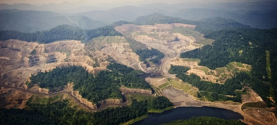
Surface Mining change over the past 3 decades in the Heart of Appalachia. This study area location is contained within the region outlined by the heart in the following image(click image for source)

The study found that 2,900 km2 of land has been mined over the last 30 years. Adding this more-recent mining to mines prior to 1985, a cumulative mining footprint of 5,900 km2 has been estimated.